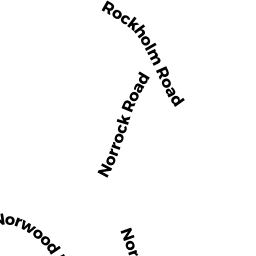
27 NORROCK RD
Owner Information
CHU MICHAEL & COWLING VICTORIA
33 COLBERT RD E
WEST NEWTON, MA 02465


Property Details
27 NORROCK RD is classified as a Single Family Residential (Cape cod).
The primary structure on this property was built in 1956. There are 4,931ft2 of built area within this property. There is 2,284ft2 of residential/living space within this property.
27 NORROCK RD is valued at $1,328,400. The land is valued at $865,300 and the structures are valued at $433,300. There is an additional valuation of $29,800 on this property.
This property is in Zone R-20. Confirm with local Zoning Board authorities to ensure there are no overlays or other easements on this property.
The most recent deed for 27 NORROCK RD is recorded at the local registrar in Book 16016, Page 574. 27 NORROCK RD was last sold on Thursday, October 28, 1999 for $665,000.
Assessment data from fiscal year 2022.
Flood Data
According to the FEMA National Flood Hazard Layer, this property does not appear to be in a flood zone. It may also be in an area not yet reviewed. Nonetheless, confirm this information prior to taking any action.
To view the flood hazards around this property, create a FEMA "Firmette" Map of the area around 27 NORROCK RD.
Broadband Internet Providers
| Provider | Type | Bandwidth (mbps) | |
|---|---|---|---|
| Viasat Inc | Satellite | 100 | 3 |
| Comcast | Cable | 1000 | 35 |
| GCI Communication Corp. | Satellite | 0 | 0 |
| HughesNet | Satellite | 25 | 3 |
| VSAT Systems, LLC. | Satellite | 2 | 1 |
Broadband service provider data from December 2020.
Adjacent Properties
- 46R NASHUA AV
Single Family Residential owned by JOHNSON KATHLEEN - 40 NASHUA AV
Single Family Residential owned by DUNCAN ROBERT J & BARBARA MARIE - 42R NASHUA AV
Single Family Residential owned by LEVINE PHILIP & GRANT LINDA - 44R NASHUA AV
Single Family Residential owned by TRUAX RANDALL ET AL - 25 NORROCK RD
Single Family Residential owned by ANDREW EBEN S & SANDRA J - 19 ROCKHOLM RD
Undevelopable Residential Land owned by ALLEN DOROTHY B TR NOMINEE TR